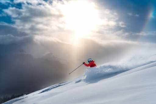
If you’re thinking the snow gods have been very generous to Colorado skiers and snowboarders so far this season, you’re right.
Nearly every ski area in Colorado is reveling in above-average snowfall, some of them well above average. And, according to OpenSnow founding meteorologist Joel Gratz, there is only one explanation for the storm cycle that has been in place for weeks: Luck.
“That’s effectively it,” Gratz said Wednesday. “There is natural variability in the atmosphere. Sometimes it works in our favor, sometimes it works against us, and this one is working for us. What often happens is, once the atmosphere gets into some sort of a pattern, it can often stay in that pattern for a while. We’ve just been lucky that we are bearing the fruit, or the snowflakes, of this pattern.”
Last fall the U.S. Climate Prediction Center’s 90-day forecast for our region predicted above-normal temperatures and below-normal precipitation. Instead, the opposite has occurred. Temperatures have been mostly normal or colder, while the Colorado snowpack as a whole stands 26% above normal.
According to figures posted by OpenSnow, three ski areas — Steamboat, Powderhorn and Sunlight — have snowpacks that are more than 40% above normal. Seven more are 30-39% above normal, including Beaver Creek, Buttermilk, Crested Butte, Monarch, Purgatory, Snowmass and Vail. Another seven stand at 20% to 29%. Only two are currently below average, and barely so: Breckenridge (97%) and Cooper (99%).
Here’s another eye-popping number: Rocky Mountain National Park stands at 60% above normal.
“Most years are not like this,” Gratz said. “Most years we are begging for the next storm. We’re looking at the 10- or 15-day forecast to see if there is a chance (for a storm), and maybe it’s a one-and-done type of deal where you get one storm (followed by) seven or 10 days of dry weather. This year it’s happening almost perfectly.”
Another positive aspect of this snow cycle is that storms have been coming from multiple directions, and that spreads the wealth around.
“While you can look at the snowfall maps and see the central and northern mountains have a deeper snowpack versus the southern mountains, the southern mountains just got multiple feet of snow — they’re not hurting in any way,” Gratz said. “These storms have been somewhat equal-opportunity storms when you look at the last month or two. Most mountains are getting plenty of snow.”
That also means nearly ever mountain range in the state currently has “considerable” avalanche risk, as of Wednesday morning, according to the Colorado Avalanche Information Center.
Gratz doesn’t see a lot more snow coming over the next week, although there is the potential for some mountain snowfall at the end of this week and the middle of next week. Following that, Gratz sees the potential for a “snowier pattern” around Jan. 15th-16th.
And that would represent more luck: That’s the MLK holiday weekend.
Subscribe to our weekly newsletter, The Adventurist, to get outdoors news sent straight to your inbox.
Source: Read Full Article


