Colorado is blessed with an abundance of open spaces and trails for hiking, mountain biking, dog walking, cycling, horseback riding and just about any other activity you can think of. But they can be crowded and it can be hard to narrow things down when you’re somewhere to go.
This summer, maybe try something new. Throughout the state, trails are being created — largely with the help of volunteers — to expand our systems. (Find volunteer trail-building opportunities through organizations such as Colorado Trail Foundation and Volunteers for Outdoor Colorado.)
So, if you’re looking for an adventure and some fresh views, try one of these six paths, from Mancos to Royal Gorge to Conifer.
The Aqueduct Trail System, Mancos
Officials held a ribbon-cutting in May to show off the first four miles of what is expected to be 12 miles of new trails near this southwestern Colorado town. The system is located on the Bureau of Land Management property and was created in partnership with the Mancos Trails Group. Work and fundraising are ongoing this summer to complete the other five miles.
Length: There are currently 7 miles of trail that include Moonscape, Evenflow, and Ridges trails
How it looks: Juniper, sagebrush, and pinyon dot the landscape as you look out on views
of Mesa Verde and the Sleeping Ute and La Plata Mountains
Who can use it: Hikers, traditional cyclists and class 1 e-bikers, dog walkers, and
horseback riders
The Chicken Creek Trail System, Mancos
Crews from the National Forest Service, the Southwestern Conservation Corps and local volunteers are working to complete the final part of this 12-mile system of single and double track trails by the end of summer. They connect to the Colorado Trail and Mancos State Park.
Length: 10.5 miles are currently open
How it looks: Mainly forest with seasonal wildflowers; mostly shaded with a few creek crossings, including those on the Blue Jay and Lost Chicken trails
Who can use it: Hikers, equestrians, mountain bikers, and dogs are permitted
The Royal Cascade Trail, Cañon City
This beautiful trail, which was completed in March, connects Tunnel Drive with Fremont Peak and the Royal Gorge Park Trails, but maybe the most important thing to know is that it’s quite a workout. In fact, with steep drop-offs and the exposure going uphill, Royal Cascade isn’t for beginners and is described as a “double black diamond” level for mountain bikers with 1,800 feet of elevation gain. Some compare it to the Manitou Incline for intensity. Also note that there are seasonal closures for bighorn sheep lambing in June and July. (Fremont Adventure Recreation, which helped build the trail, provides up-to-date conditions and maps on its website.)
Length: 3.6 miles (note that is just for this section; there is additional mileage depending on how you access this trail)
How it looks: Expect to be exposed to the elements while navigating the switchbacks and taking in the views of Cañon City and surrounding scenery.
Who can use it: Hikers, mountain bikers, leashed dogs
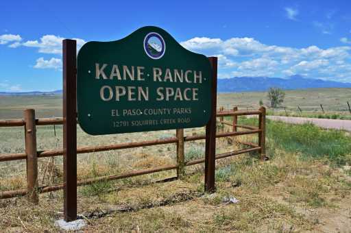
Kane Ranch Open Space, El Paso County
The 3.5-mile Lariat Loop Trail opened in the Kane Ranch Open Space in March amid 495 acres east of Fountain. More trails may be added here in the future, where the existing trail is wide enough for two horses to go side by side with their riders under wide open skies. Take time while here to read and learn about the history of the Kane Ranch and its colorful owners from the 1940s. Oh, and be aware: this is rattlesnake country!
Length: 3.5 miles
How it looks: Prairie grasslands, a few cottonwood trees
Who can use it: Hikers, horseback riders, cyclists, leashed dogs
Santa Fe Open Space, El Paso County
In this open space area, you can find 2.5 miles of connecting trails on 60 acres that can be a loop. You will see Elephant Rock, Mount Herman and several other peaks as you curve around on the dirt trails. The trail names, like Burlington Trail and Ranch Road, evoke the history of the area.
Length: 2.5 miles (plus either .5 miles or 2.5 miles on the Santa Fe Trail, depending on
where you park)
How it looks: For most of the trail, you are flanked by scrub oak and in some patches, ponderosa pines and wildflowers. Views of the towns of Palmer Lake and Monument, plus red rock formations and mountain views to the south and west.
Who can use it: Hikers, mountain bikers, equestrians, leashed dogs
North Elk Creek Trail, Staunton State Park
The North Elk Creek Trail, completed last spring, creates a connection between Staunton State Park, near Conifer, and adjacent U.S. Forest Service land. Set above 8,000 feet, it is closed from mid-March through mid-June for elk calving. Be sure to check the park’s website for seasonal connector trail closures and other updates.
Length: 5.2 miles (not including miles to access this section)
How it looks: Thick forest, with rocks and roots and creek crossing
Who can use it: Hikers, mountain bikers, equestrians, dogs on a six-foot leash or shorter
(Note: entry to the state parks costs $10 per day per vehicle.)
Subscribe to our weekly newsletter, The Adventurist, to get outdoors news sent straight to your inbox.
Source: Read Full Article


