


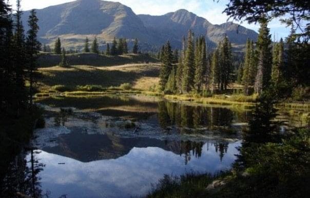
There are few moments as lovely as standing atop a mountain you conquered with your own two feet, alone and in awe of the quiet solitude one can find high in the Rocky Mountains.
If your summer hobby is climbing the fourteeners (peaks that rise above 14,000 feet), such solitude can be elusive. More than 500,000 people a year hike one of these 54 mountains, and some, especially on the Front Range, can seem more like a conga line than a wilderness experience. But lower your elevation standards a bit and you may experience peace and quiet that’s becoming more rare on the fourteeners. Colorado has more than 600 thirteeners, many just as challenging and beautiful as the higher peaks.
We’ve put together a list of 10 that are worthy of a visit, from gentle strolls off a paved mountain pass to rugged backcountry adventures, arranged in order of difficulty. Keep in mind that the same safety guidelines apply for these peaks as the fourteeners: Get an early start to avoid afternoon thunderstorms. Bring more water and food than you think you’ll need. Be prepared for any weather. Have a map. And, of course, don’t forget a camera.
Mount Sniktau
- Elevation: 13,240 feet
- Location: White River National Forest
- Distance: 4 miles
- Elevation gain: 1,580 feet
This peak is so accessible that many people climb it in winter. You can drive to nearly 12,000 feet on Loveland Pass, and from there it’s a simple ridgeline stroll up the north side of the pass. Off in the distance you’ll see fourteeners Grays and Torreys, where hordes of hikers are likely swarming the trails. You just may have Sniktau’s summit to yourself.
Turner Peak
- Elevation: 13,233 feet
- Location: San Isabel National Forest
- Distance: 2.6 miles
- Elevation gain: 2,000 feet
Cottonwood Pass west of Buena Vista pierces the alpine tundra of the Collegiate Peaks at 12,126 feet in summer. This knob of a mountain is a short but occasionally steep hike away. The majesty of the Collegiates spread out in all directions is worth every step.

Mount Owen
- Elevation: 13,070 feet
- Location: Gunnison National Forest
- Distance: 4 miles
- Elevation gain: 1,800 feet
The Elk Mountains of Crested Butte are a grand spectacle, and this peak in the Ruby Range is one of the most accessible. Starting at the Lake Irwin Campground (temporarily closed in the summer of 2022) it’s a modest walk up a rough road past old mining buildings, then a steep ascent to the top of the range. One can easily summit all three peaks in this range, but resist the urge to try to make a loop because there is no safe way down.
Baldy Cinco
- Elevation: 13,383 feet
- Location: Rio Grande National Forest
- Distance: 7 miles
- Elevation gain: 2,485 feet
The La Garita Range is one of Colorado’s lesser-visited, with only one fourteener, but that means innumerable opportunities for solitude. This huge hump of a mountain is located just off Spring Creek Pass between Lake City and Creede. Starting at the top of the pass, it’s a steep ascent along the Colorado Trail. After emerging above timberline simply stroll across the vast tundra to the summit spire.
Bald Mountain
- Elevation: 13,684 feet
- Location: Arapaho National Forest
- Distance: 7 miles
- Elevation gain: 2,700 feet
Boreas Pass, driveable in summer only, connects Breckenridge with South Park, offering endless opportunities for hikes among the tundra. Reaching this summit entails a walk up an old mining road followed by a pleasant tundra stroll. Like the name suggests, you won’t find many trees.
Parry Peak
- Elevation: 13,391 feet
- Location: Arapaho National Forest
- Distance: 5.5 miles
- Elevation gain: 2,800 feet
This peak is an easy day trip from Denver. It’s one of the high peaks you see in the distance from Interstate 70 heading west out of the city. It’s also highly visible while skiing Winter Park. The way is occasionally steep and mostly off-trail, starting at Fall River Reservoir. On a clear day you may see the skyscrapers of downtown, but you’ll feel a world away.

West Spanish Peak
- Elevation: 13,626 feet
- Location: San Isabel National Forest
- Distance: 8 miles
- Elevation gain: 2,600 feet
The Spanish Peaks are so prominent an entire region of southern Colorado is named for them. Though higher than its neighbor East Spanish Peak, West Spanish Peak is actually the easier to summit, as you can drive high up on the mountain via Cordova Pass. Starting at a small campground across the dirt road, it’s a modest hike at first but soon becomes steep as you follow rock cairns up the side of the talus heap. From the top, the Sangre de Cristo Mountains dominate the view in all their glory.

Spread Eagle Peak
- Elevation: 13,423 feet
- Location: San Isabel National Forest
- Distance: 14 miles
- Elevation gain: 4,000 feet
The Sangre de Cristo Wilderness has more stunning lakes per square mile than any other in Colorado, and this hike will take you to three of the most amazing, the Lakes of the Clouds. Starting at the Gibson Creek trailhead near Westcliffe, it’s a short but steep ascent up the Swift Creek Trail to the lakes. Spread Eagle towers above to the south. Most sane hikers set up a backcountry camp and climb the next day, but a strong hiker could do the entire thing in a day, though why would you want to rush and not enjoy such a beautiful area?
Mummy Mountain
- Elevation: 13,425 feet
- Location: Rocky Mountain National Park
- Distance: 16 miles
- Elevation gain: 4,885 feet
The Mummy Range, known for long, gentle peaks, is one of the lesser-visited areas of Rocky Mountain National Park. That’s because it’s a slog to reach, and these peaks are most easily climbed after spending the night at one of the backcountry campsites near Lawn Lake (reservations required.) This quiet area might not have the dramatic appeal of Longs Peak or Trail Ridge Road, but visit and you’ll find a new way to look at this busy park.

Cathedral Peak
- Election: 13,943 feet
- Location: White River National Forest
- Distance: 9 miles
- Elevation gain: 3,900 feet
This jagged, imposing peak near Aspen gets the “most difficult” spot on this list not for mileage, but a hand-over-hand ascent of a steep couloir. The rock is so loose many hikers prefer to climb it when snow still fills the route. In whichever season an ice axe and helmet are a good idea. The climb will take your breath away and the view of the Elk Mountains and Maroon Bells from the summit will drop your jaw.
Subscribe to our weekly newsletter, The Adventurist, to get outdoors news sent straight to your inbox.
Source: Read Full Article